Vancouver explores the Coast - 37 cents 1988 - Canadian stamp
Specifications
- Quantity: 3 658 800
- Issue date: March 17, 1988
- Printer: Ashton-Potter Limited
- Scott: #1200
Description
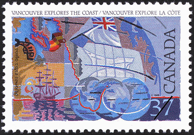
In the 18th century, new scientific equipment allowed explorers to survey land and sea with greater accuracy than ever before. Some of George Vancouver's maps, in fact, are still in use today. Trained as map-maker under Captain James Cook, Vancouver undertook a round-the-world voyage from 1791 to 1795, covering 105,000 kilometres. He surveyed the west coast from 30o to 60o N., and was so intent on mapping the coastline that he missed the Columbia River. Nevertheless, he would eventually dispel the myth that a Northwest Passage existed at these latitudes. Artist Frederick Hagan of Newmarket, Ontario painted these four images, third in the series of Exploration stamps. Using a palette of vivid colours, he depicts the lands carted by four 18th century explorers. His imaginative backgrounds detail charts, map-making tools and the Discovery, the ship Vancouver sailed on his voyage around the world.
Canada Post Corporation. [Postage Stamp Press Release], 1988.
Creators
Designed by Frederick Hagan
Note
The values on this page are in Canadian dollars (CAD).